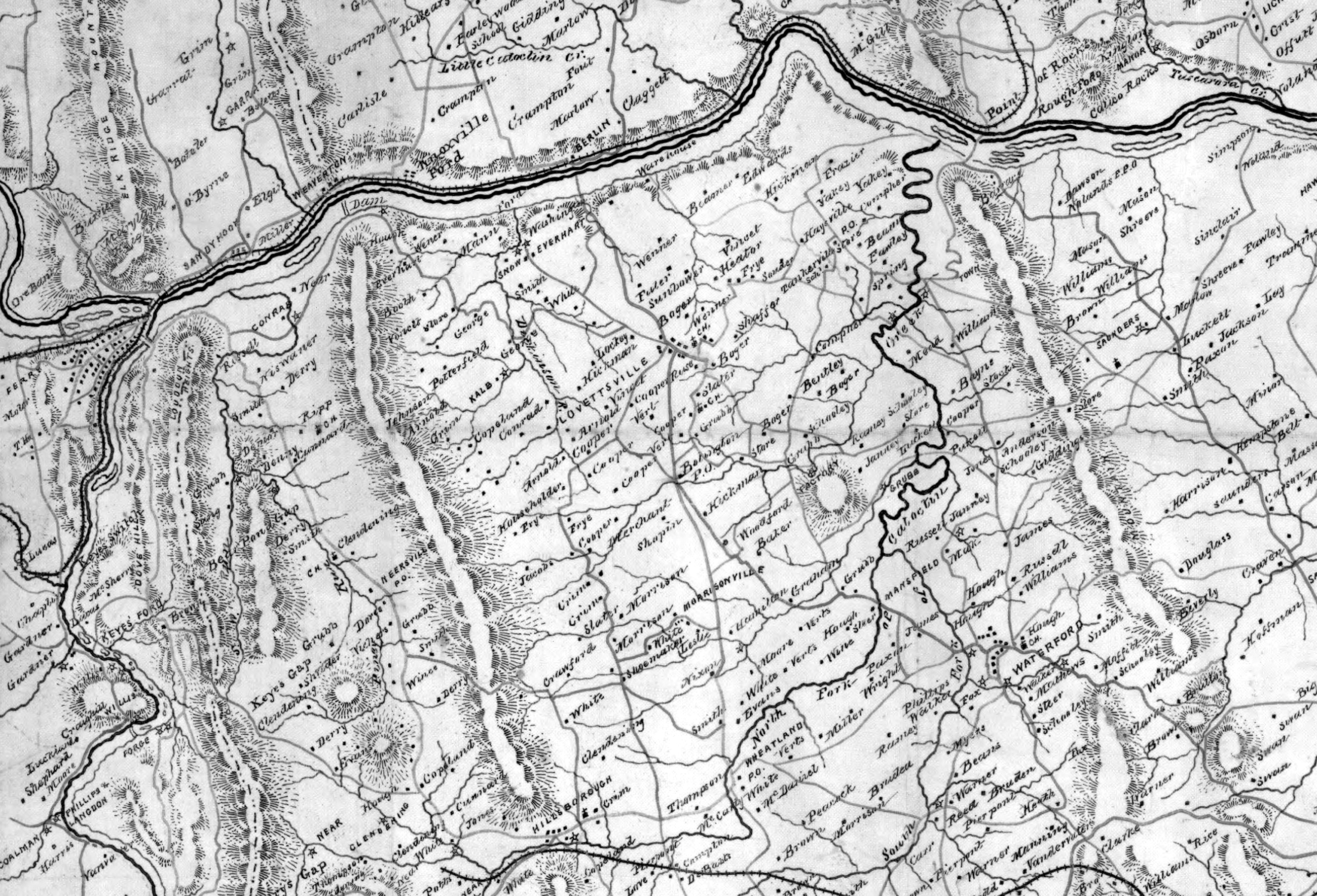
Cropped detail of the area of Lovettsville, Virginia and environs from the Civil War map titled “1863 Map of Fauquier & Loudon [sic] Counties, Virginia, By order of Lt. Col. William. P. Smith, Chief Engineer, Topographical Office of the Army of Northern Virginia, Copied by A. S. Barrows, Assistant Engineer.” Note that the names on the map are of the local property owners. Red lines indicate roads, blue lines are creeks, and the double-black line is the Potomac River. Download the entire full sized 1863 map of Fauquier and Loudoun Counties at https://www.loc.gov/item/2002627439/

![1863 ORIGINAL Map of Fauquier & Loudon [sic] co's. Va.cwh00033 copy](http://www.lovettsvillehistoricalsociety.org/wp-content/uploads/2018/06/1863-ORIGINAL-Map-of-Fauquier-Loudon-sic-cos.-Va.cwh00033-copy-1024x848.jpg)
Click image to download map from the Library of Congress.